Kier Lindsay
Developer
Developer
I graduated from Simon Fraser University with a bachelor's degree in computing science and a minor in philosophy. During my time at school I focused on artificial intelligence and computer vision. Over the years I have developed a breadth of technical knowledge and awareness of the impact technology has on how humanity lives. As the effects of the internet revolution are accepted by the masses necessarily large quantities of data are being produced every second. This next stage in my career is focused on founding ENDpoint Ventures to develop cloud first geospatial data solutions and tools. These aim to provide end users and companies who generate and gather data to unrivaled access to the fruits of their hard work and enable sharing it with less technical people. Allowing every day users to be empowered by their data.
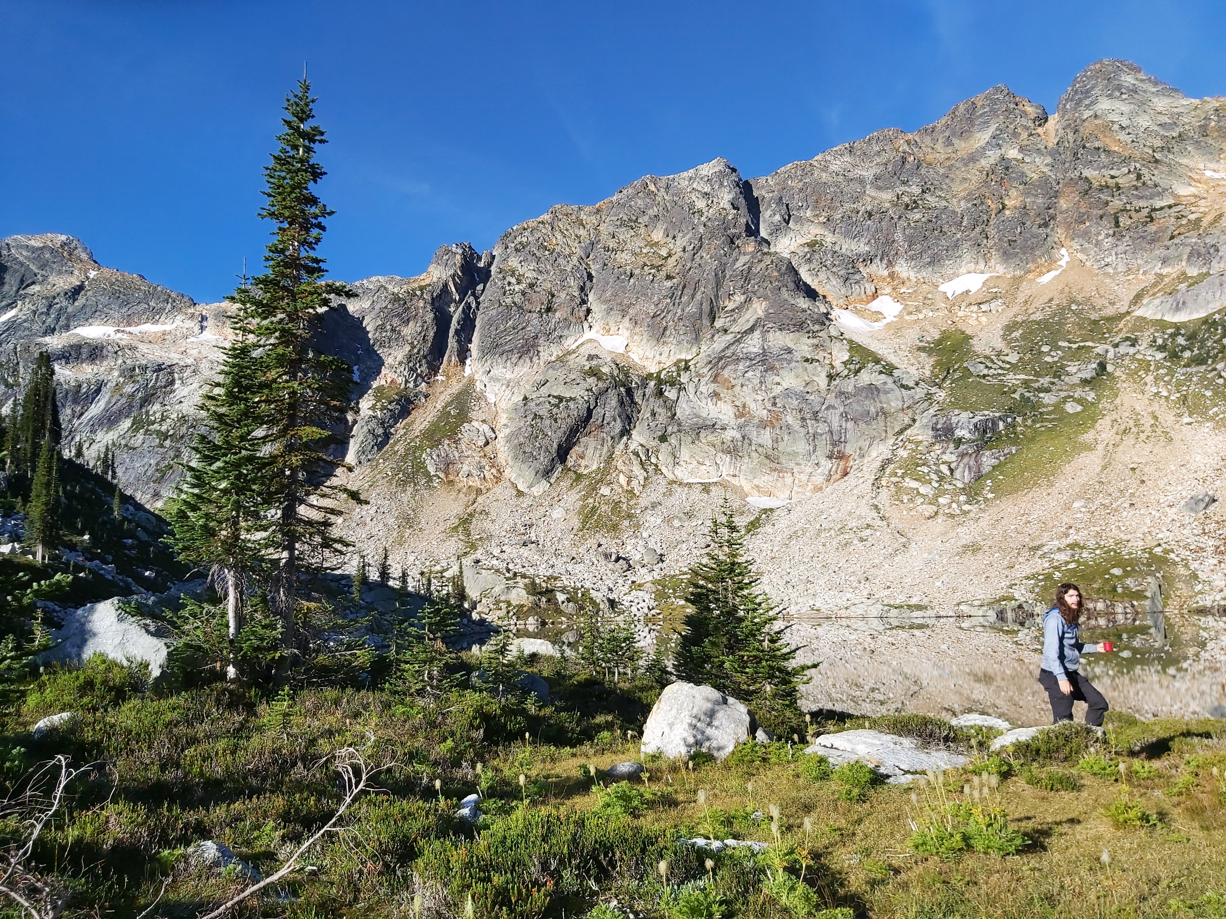
I am a person that values the world around us. I hope that the world becomes a fairer, cleaner, more caring
place that allows us all to live our lives freely, happily and beautifully. I personally hold myself to
these values and hope to enjoy learning and discovery more about you and yours. If nothing else consider the
value in others personality as we all have the
shared goal of.life.
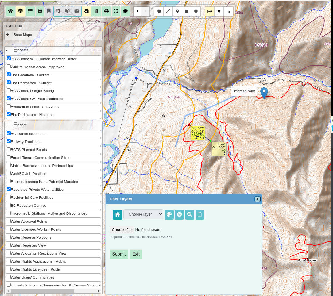
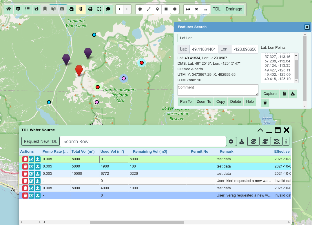
Originally PLANmap; A web mapping tool developed on Postgres Leaflet Apache2 and Node.js which delivers spatial data and Open Web Services to clients. This system includes a full authentication and user management system as well as semi automated module deployment. Tech used: Leaflet, SlickGird, Bootstrap, jsPDF, GeoServer, WMS, pm2, es6, grunt, L.draw, geojson, node-pg, ejs, express, and more.
Visit ENDpoint For Details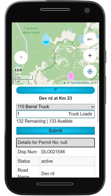
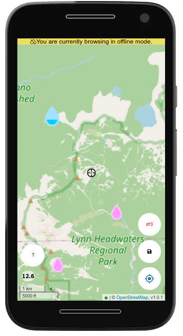
An offline capable leaflet progressive web app which I built in a
few months. This app allows clients to track critical licensing
requirements and is integrated with our authentication system and
database management tools. This was designed to be user-friendly for
the contractors that will be using it in the field.
Tech Used: Service Worker API, JWT, PouchDB.

Still under development but a very promising technology is decentralized web apps (DAP) Recently I have been working with the innovative Graph Universal Node (GUN) Library to produce a vanilla framework for communication that is easily added to any JS application. This tech is in its infancy but the fundamental library allows for easy extensibility while simplifying some complex and/or unintuitive parts of GUN. It will evolve to have more high level decentralize utilities.
View Project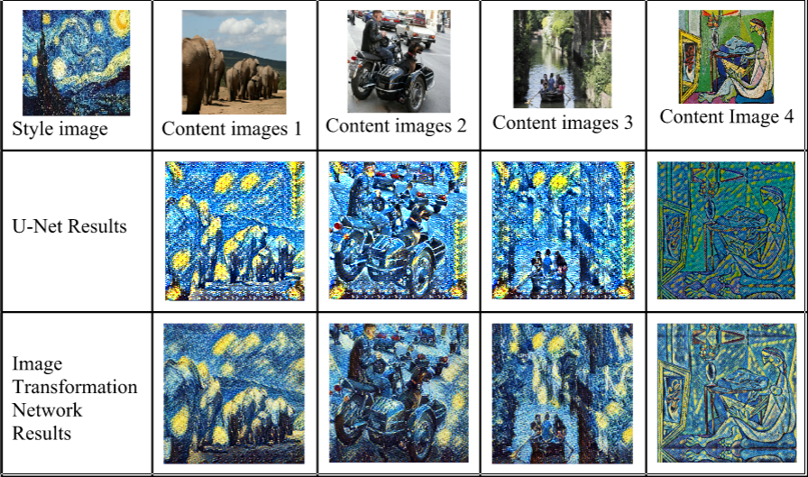
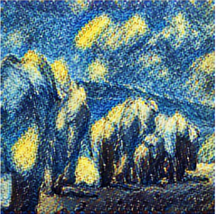
This is a machine learning group project where my team and I tested the use of U-nets for image style transfer using Python/TensorFlow and the Google Cloud Platform
View Project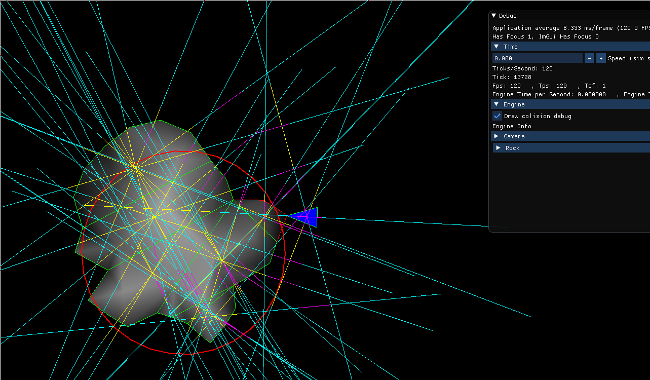
This is a personal project in which I am developing a small game from scratch in C++/SFML I have created a number of low level game systems for this project such as a collision detection system and game time management system.
Specializing in software development, advanced algorithms, artificial intelligence and value theory. Grad Fall 2021
Endpoint Ventures specializes in building cloud first geospatial data applications. Our ENDpoint products let the tech do the heavy lifting so that YOU get the answers you need without barriers. Access, manage and share your data any time from anywhere, with a few simple clicks. We believe that using geospatial data shouldn’t be hard, expensive or tedious, that’s why we build the solutions which break down technology barriers and empower your entire organization to use geospatial data. 6 months from now the only question will be who will love it more, you or your clients.
May 2016 - August 2021
Manager Lead Tech
Summer Installation Technician